Soil evaluation and sustainable farming methods
Bihar is situated on the World’s fertile alluvial plain of Gangetic Valley which extends from the foothills of the Himalayas in the north to a few miles south of the river
Ganges as it flows through the State from the west to the east. Variation in relief, precipitation, vegetation, and parent rocks have resulted in various soil varieties due to the region relief features. The foothills of Kaimur consist of alluvial soil and are naturally fertile. But the soil becomes harder as one proceeds southwards. As one moves up the foothills, the soil becomes stony and poor in fertility. The Kaimur plateau is an undulating tableland having thin shrub jungles and the land is not very fertile. The proposed
work is to be undertaken for the analyses of the soil for its physical state, its constituents and the nutrients, present in the soil. Different physio-chemical characteristics of the Kaimur (formerly known as Bhabua) region of Bihar State have been determined using standard methods.
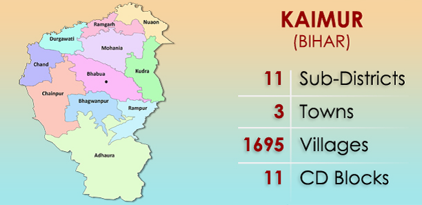
Bhabua district, located in the extreme south-western part of the State extends between the north latitudes 24 0 -54’ and 250 -20’ and east longitudes 83 0 -20’-00” and 83 0 -40’ and falls in the Survey of India toposheet no. 63 O and P. Kaimur district is a part of Patna division.